NHC 7:00am Update on TS Marco and TS Laura
We have the latest updates from the National Hurricane Center on Tropical Storm Marco and Tropical Storm Laura.
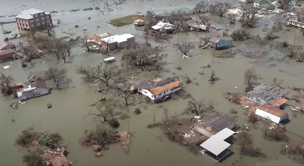
Two storms have never been seen in the Gulf of Mexico at the same time in recorded history, and it appears SWLA will get hit by both storms. How lucky are we to make history?

The 7:00am NHC update on Tropical Storm Marco shows the storm tracking to make landfall at around 1:00am tomorrow morning. SWLA will feel tropical depression force winds later in the day. There was great news overnight of the pressure dropping in the storm and it becoming more disorganize, dropping down from a hurricane to a tropical storm.

SWLA will be positioned on the east side of the storm, which is typically the more dangerous side. The wind directions on that side of hurricanes cause more flooding than the western side of the storms, and they're more likely to spawn tornado activity.
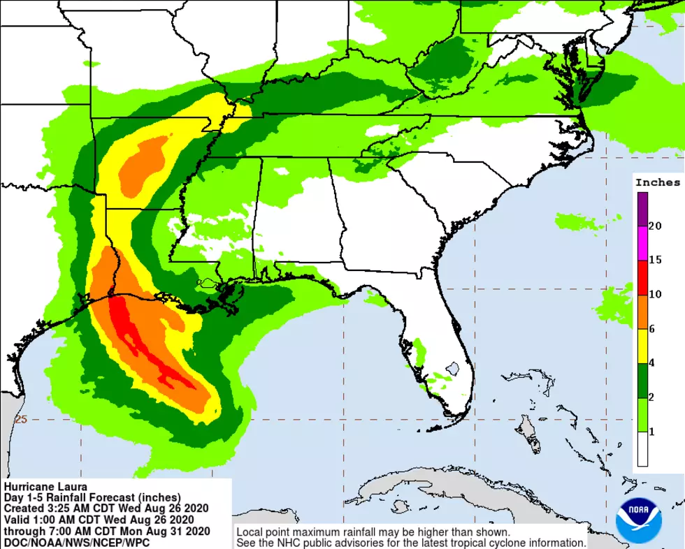
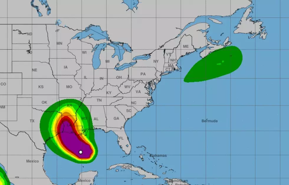
The new NHC update on Tropical Storm Laura shows the storm tracking to become a hurricane early Wednesday morning and make landfall Thursday at 2:00am, with a path to make a direct hit to SWLA.

Please be prepared for these storms.

Essential Items for Your Hurricane Kit
More From 96.5 KVKI