Tropics Still Active But Not As Threatening For Now
Hurricane Dorian has finally come and gone. After being the headline of the weather world for more than a week the storm system has finally lost its tropical characteristics and the remnants of the once-powerful storm system are move across the northern Atlantic Ocean this morning.
Meanwhile, as we sit here on the eve of the peak of the Atlantic Tropical Season we can report that the tropics are still active. They are just not as threatening, at least in the near term, as they were last week.
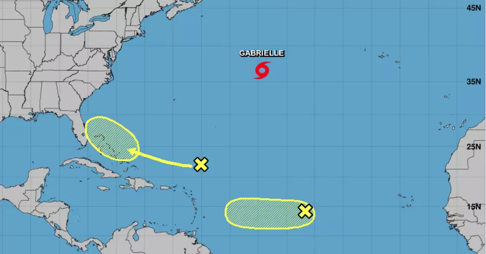
There are three areas of tropical weather that are being monitored. One of those areas is Tropical Storm Gabrielle. That system earned a name last week and will likely lose that moniker sometime later this week. The storm system is forecast to stay over open water and eventually lose its tropical characteristics as it approaches Ireland late in the day on Wednesday.
There is an area of disturbed weather over the Bahamas. Unfortunately, that system is adding insult to injury left behind from Dorian. The National Hurricane Center does not give this system much of a chance to get stronger as it moves toward the east coast of Florida over the next five days.
Forecasters are also monitoring a tropical wave that rolled off of Africa late last week. This system showed signs of growing stronger as it moved across the Atlantic Ocean but that doesn't appear to be the case this morning. The Hurricane Center is only giving this system a 30% probability of strengthening into a tropical cyclone over the next five days as it approaches the Leeward Islands.
More From 96.5 KVKI