Nicholas Makes Landfall in Texas as a Hurricane
Hurricane Nicholas made landfall along the Texas coast just after midnight this morning. The storm, which had been classified as a hurricane for only a few hours is expected to weaken as it slowly moves onshore throughout the course of the morning.
The National Hurricane Center said that Nicholas crossed the coast on the eastern portion of the Matagorda Peninsula about 12:30 am with maximum sustained winds at 75 mph. The storm’s landfall was very near where Hurricane Harvey made landfall back in 2017. Although Harvey was a much stronger storm, the damage from Nicholas could still be quite extensive.
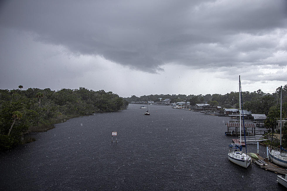
While 75 mph winds can create damage the real effects of Nicholas will be felt much further away from the storm’s center of circulation. In South Louisiana, flood watches and warnings have already been posted in anticipation of flooding rains from the storm.
Forecasters with the National Weather Service in Lake Charles are suggesting that rainfall amounts of four to eight inches will be common from Lake Charles through Lafayette and even further east. Some pockets of rainfall could exceed a foot or more.
This could lead to widespread flash flooding across the area especially since the heavy rain is expected to persist throughout the next several days. There could be some minor stream and river flooding associated with these tropical rainbands as well.
As is common with landfalling tropical cyclones there is a potential for severe storms and tornadoes. The area under the gun will be to the north and east of the center of the storm’s circulation and if you check your maps, you’ll see that puts a big bullseye on South Louisiana.
There have already been tornado warnings issued early this morning for Cameron Parish. Those kinds of warnings will be likely over the next 12 to 24 hours in portions of southwestern Louisiana and southeastern Texas. Quite often tornadoes that accompany landfalling tropical cyclones are hard to see as they are usually wrapped in very heavy rainfall.
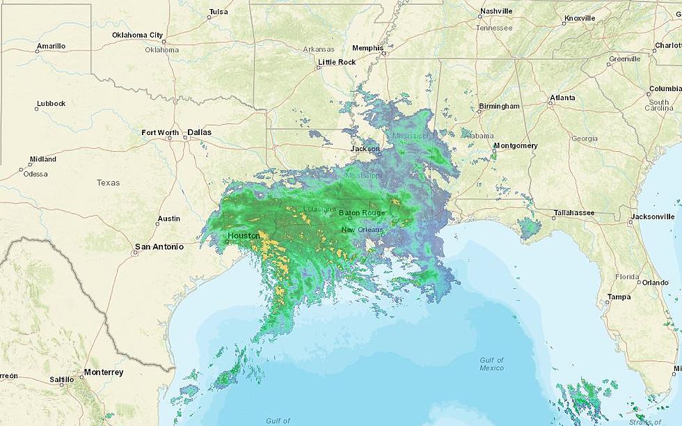
The current scan of the Lake Charles radar from the National Weather Service forecast office shows that the heaviest precipitation is over extreme southwestern Louisiana this morning. The fact that Nicholas or the remnants of Nicholas are anticipated to slow down in forward speed and then turn toward the east means that our part of the world will have the potential for heavy rain through at least Wednesday evening.
Currently, all of southwestern Louisiana is under a flash flood watch. There are some flood warnings along area rivers and streams that have been posted as well. The forecast office for the Weather Service in Lake Charles suggests that the Lafayette area will receive an additional one to two inches of rain during the day today, with isolated amounts approaching three inches.
Winds associated with Nicholas will be gusty across the region as well. They shouldn’t reach tropical storm velocity but gusts in excess of 20 mph will be common across much of the I-10 corridor. Drivers of high-profile vehicles are encouraged to plan ahead and expect gusty conditions, especially on the east-west oriented roadways.
LOOK: The most expensive weather and climate disasters in recent decades
Gallery Credit: KATELYN LEBOFF
More From 96.5 KVKI


![Texas Lawyer Dressed as Michael Myers from Halloween Strolls Galveston Beach Ahead of Tropical Storm Nicholas [Videos]](http://townsquare.media/site/33/files/2021/09/attachment-Average-Joe-and-the-Clones-2.jpg?w=980&q=75)


![Local Damage Caused By Hurricane Laura [GALLERY]](http://townsquare.media/site/180/files/2020/08/Tree-Down-1.jpg?w=980&q=75)